In early 2026, southern and central parts of Australia experienced significant flooding after weeks of heavy rainfall. A slow-moving tropical low-pressure system brought intense rain across large inland areas and eventually moved toward the southeastern states. The storms produced flash floods, road closures, and disruptions to travel and local communities.
 Satellite image acquired at 06:10 UTC on February 25, 2026. Credit: JMA/Himawari-9, Zoom Earth, The Watchers
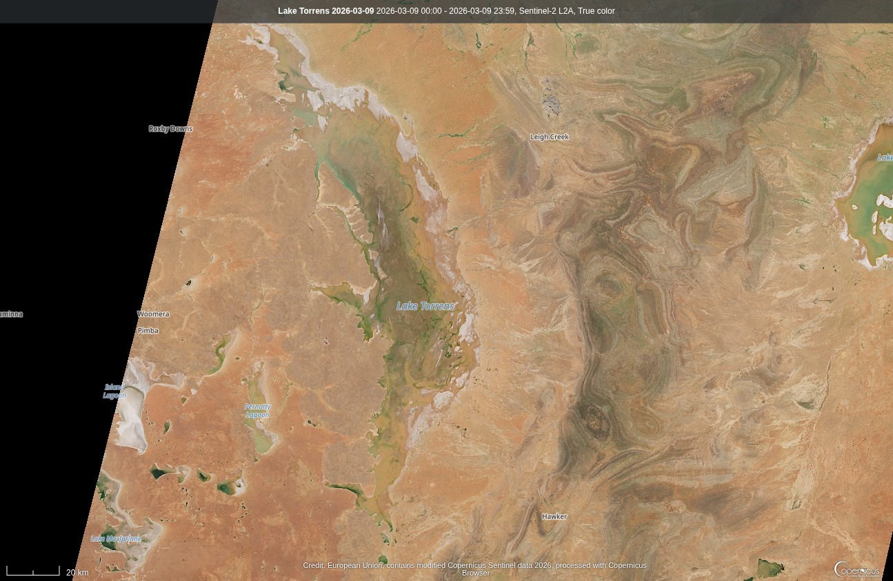
Next, we will take a closer look at the Lake Torrens flooding, to the north of Adelaide.
Southern Australia (Lake Torrens)
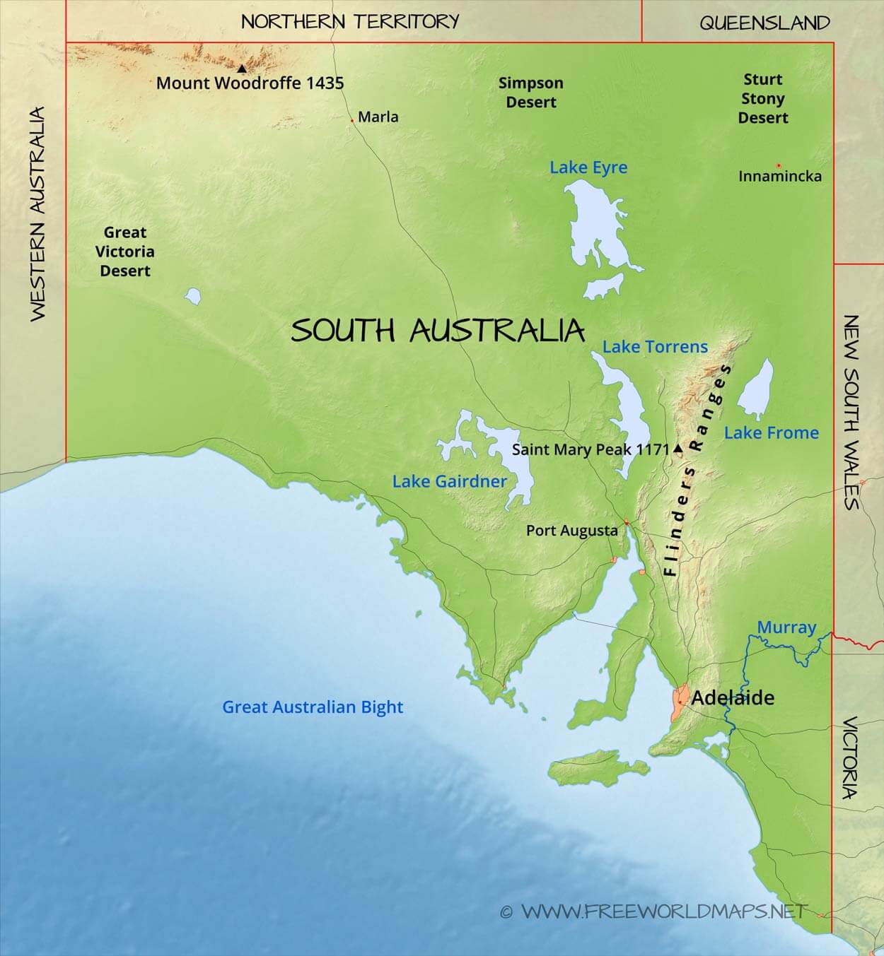 Photo by freeworldmaps.net
Lake Torrens stretches approximately 250 kilometres in length and 30 kilometres in average width.
The lake is approximately 30 metres above sea level, with a maximum depth of 1 m.
Unlike typical lakes, Lake Torrens has no water inflow, is usually a salt lake and dry.
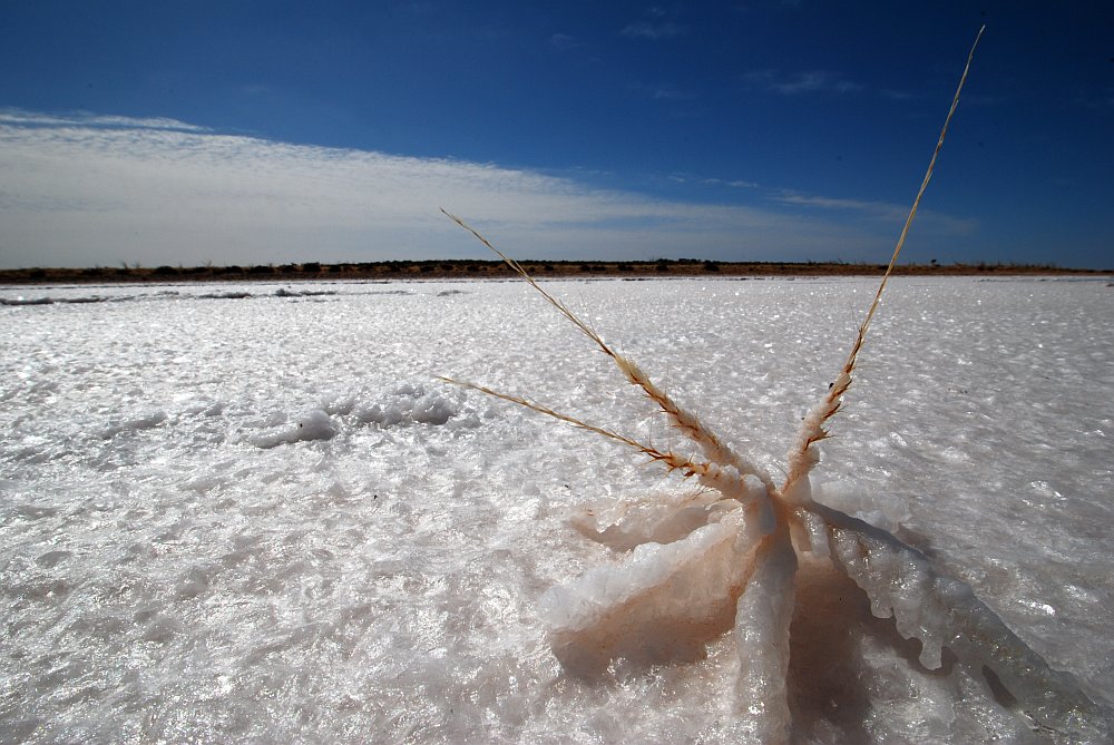 Photo by southimage.net
However, during rare periods of heavy rainfall, water flows into the basin, transforming it into a shallow, temporary lake.
The area is normally very dry, in average there are only a few hundred milimeters of rain each year.
Last time it was flooded was in October 2022.
The water usually seep away and evaporate again after a while.
In 1989, due to extreme rainfall this was only partially the case. The lake flooded to such an extent that water flowed through the Pirie-Torrens corridor and on into Spencer Gulf and thus into the sea.
Rainfall Comparison
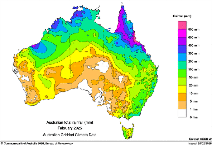
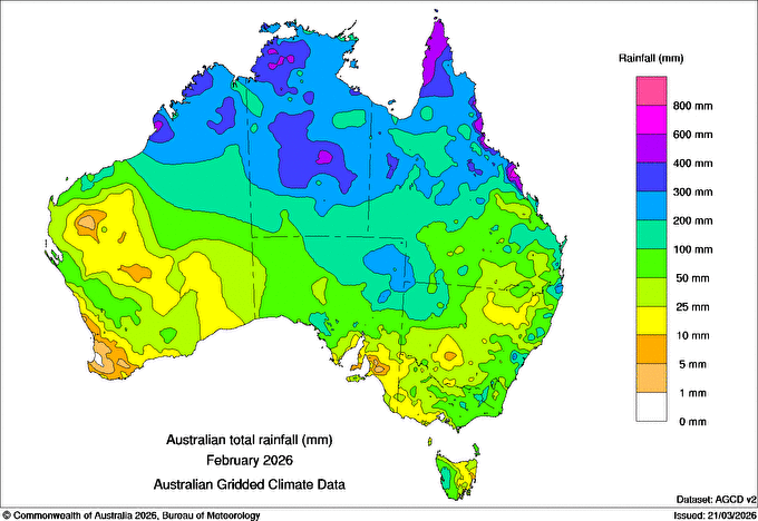 If we compare the total rainfall in SA in 2026 with 2025 there was a lot more in 2026 and so Lake Torrens got flooded.
Flooded areas March 10 2026
With the help of a satellite flood product and some coding the following was created.

 Most of the Water-flag here is considered seawater. However, an area of almost 6,000 km² is currently at the land flooded. This corresponds to an area almost twice the size of the state of Vorarlberg.
High Quality Foto Sentinel-2
Conclusion
Overall, the 2026 flooding in southern Australia highlights how extreme weather events can quickly impact large areas.
Links:
BOM
NASA Earth Observation Data
MODIS/VIIRS NRT Global Flood Products Documentation
MODIS/Aqua+Terra Flood Map Daily L3 Global 250m LLL Grid NRT
Copernicus, Sentinel-2
Lake Torrens (Wiki)